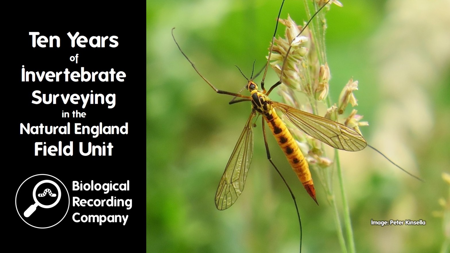
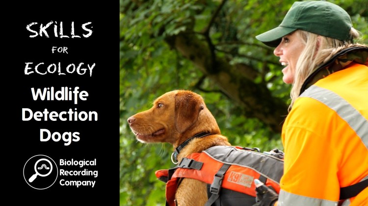
This second iteration of the Natural England Field Unit (NEFU) will celebrate its tenth year in 2024. NEFU currently has 5 entomologists working on condition assessments for the organisation, as well as contributing to a host of other entomological work, including DNA work, supporting PhDs, training and a range of other work. Pete will introduce a range of this work, showing the valuable entomological work NEFU does.
Pete Boardman FRES has worked in the Natural England Field Unit (NEFU) since 2016, having previously run a number of training projects at the Field Studies Council for a decade, and freelanced for thirteen as an entomologist. He was until recently national recorder of the Cranefly Recording Scheme, and has extensively taught various entomological subjects for Natural England, Universities, Wildlife Trusts, etc.
Q&A with Pete Boardman
Do the SNCOs for Northern Ireland, Scotland and Wales also have equivalent field units? I don’t believe there are equivalent field units in Northern Ireland or Scotland. They will have funding to contract out services where needed, rather than delivering surveying in-house. In Wales, they have a team of desk-based staff that undertake surveys from existing data and aerial maps. We’re very aware that we are lucky to have this team in-house as a country agency, and it is worth reiterating that the NEFU doesn’t undertake all of our invertebrate site surveys and we still need to contract out these services once we’ve reached our capacity.
Are there any freshwater specialists in the NEFU? We don’t have anybody within the field unit but always try to campaign for people with freshwater expertise as there are potential jobs that we could do if we had somebody with these skills. Currently, the freshwater work that NE undertakes would be contracted out to freshwater ecologist contractors.
Are you using any technologies to speed up the identification? Most of our methods involve traditional identification using a microscope, particularly due to the complexities of trying to identify small invertebrates in the field. The large point of what we do with the Natural History Museum is to increase the databases so that in the future we are able to get a species list from DNA analysis of the malaise trap catch.
Do you undertake any identification in the field? We are limited as to what we can do in the field because most of what we are looking at needs observation under a microscope. However, where we can identify a specimen in the field we will try to do so and release it once it is identified. We usually have an idea of which high-fidelity species we are likely to find on site so we can be on the lookout for these to limit the number of specimens that we take of these. As an entomologist becomes more experienced, the chances of them collecting rare specimens becomes lower as they have a better idea of what they’re looking for.
Can you impose a site designation if the landowner opposes it? Natural England does have the power to do this. It can get quite expensive as it needs to go through the courts and we’d need to engage with legal experts.
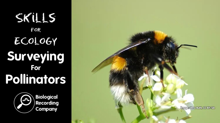
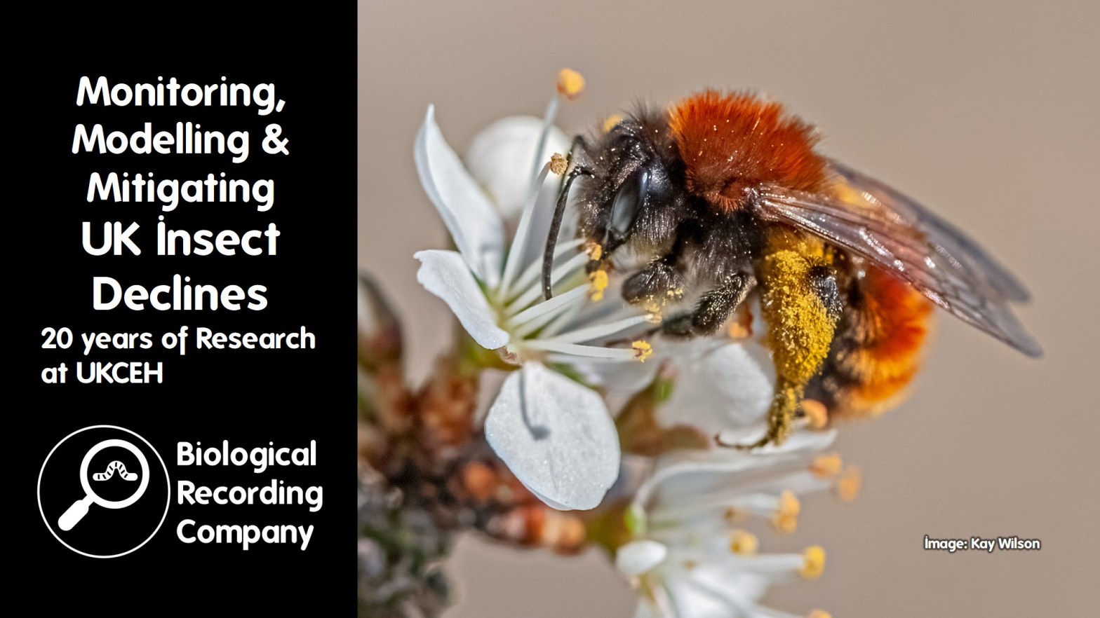
Researchers at UKCEH have played a major role in collating and analysing biological records and survey data to track changes in the status of UK insects. Claire’s talk will highlight some of the insights gained, focusing on the last 20 years, including the latest updates from the UK Pollinator Monitoring Scheme. It will also feature parallel research into management interventions on farmland to better understand how we can mitigate against further insect declines and conserve the critical ecosystem services that insects provide.
Dr Claire Carvell is an internationally renowned expert on pollinator ecology with over twenty years of research and project management experience at UKCEH. She uses a combination of field observations, experiments, molecular genetics, analyses of long-term datasets, community science and modelling approaches, interacting with a range of collaborators in different disciplines to improve environmental policy and practice. Claire’s research began with a focus on bumblebees, and she now leads the UK Pollinator Monitoring Scheme.
Q&A with Dr Claire Carvell
Which of the PoMS surveys is most suitable for schools?The Flower-Insect Timed (FIT) Count requires a lower level of identification skills, does not involve collecting specimens and can be done anywhere where there are suitable flowers (eg. gardens, school grounds, parks, countryside). PoMS resources have been adapted by the Natural History Museum in 2024 specifically for use with children by educators and this is all available as the Pollinator Countactivity on the National Education Nature Park website as a means of engaging students with the biodiversity on school grounds.
How often should FIT count volunteers aim to undertake surveys? We’ve purposefully left the timing of FIT Counts fairly flexible as we understand that the weather conditions and availability can make it difficult to commit to continuous and regular surveys. FIT Counts can be done anywhere, including gardens and parks, in warm, dry weather during daylight hours from 1 April to 30 September. We welcome surveys across different sites, but if an individual can regularly undertake surveys at the same location each week (moving to different target flowers if needed or as the season progresses) this improves the quality of the data.
Why did you select pan trapping as part of the 1km square survey methodology over a non-lethal method? We spent 2 years designing and testing the PoMS survey methods where we considered things like cost, the feasibility of getting people out into the field, the skills of the surveyors and the methods that they would employ. We were aware that the Bumblebee Conservation Trust had launched its Bee Walk Scheme (using regular fixed transects to count bumblebees) so we wanted PoMS to fill gaps in our knowledge of pollinators rather than replicate existing surveys. To get some of the smaller and/or difficult-to-identify species monitored through observational methods would be far too challenging as microscope identification is often the only way of telling species apart, and that too would involve lethal sampling. Previous research has also shown that using observers to monitor many different and diverse insect groups over a large number of sites can introduce biases, due to differing levels of experience, how and what they might ‘spot’. Pan traps provide a standardised method that can be deployed year-on-year whatever the level of surveyor expertise, whilst also allowing us to make use of expanding taxonomic capacity to ID the material following collection. We are trying to make the most of the samples by not just focusing on the bee and hoverfly species that are the main focus of PoMS, but also undertaking DNA analysis to look at a much wider range of species, many of which remain under-recorded in the UK. Pan traps are also supplemented with FIT Counts on the same 1km survey squares. UKCEH is looking to alternative methods of observational ID using cameras and AI so watch this space for this emerging technology.
Have you compared rural and urban data? Not yet. The pan trapping wouldn’t be very suitable for this as the 1 km square network doesn’t intersect with urban areas, but we can consider this question with the FIT Count data. It is something that we’d like to do and as we gather more data we get closer to being able to do this in a statistically sound manner.
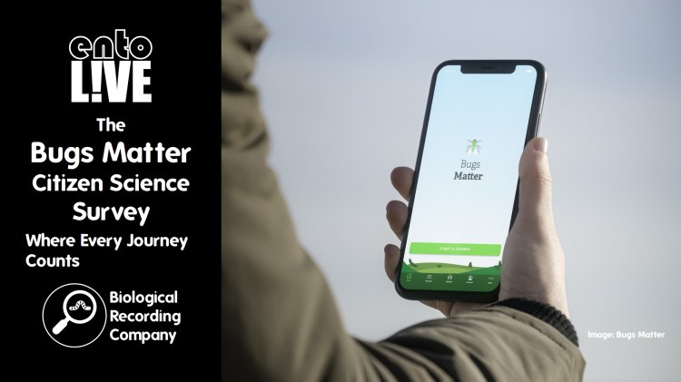
Is it true that insects have declined by over 70%? This statistic has probably come from the Bugs Matter citizen science survey that is undertaken by Buglife and Kent Wildlife Trust. This study measures the number of insect splats on vehicle number plates and last year they reported that the number of insects (in splats per mile) sampled on vehicle number plates by citizen scientists across the UK reduced by 78% between 2004 and 2023. There has also been a research paper that has reported a decline of over 75% in total flying insect biomass in German nature reserves over the past 27 years that looked at catches from malaise trapping. I can’t comment on if these studies are representative of all insects and it is important that we keep monitoring using standardised methods at large scale to gain a better understanding of what is happening across this large and diverse group of animals.
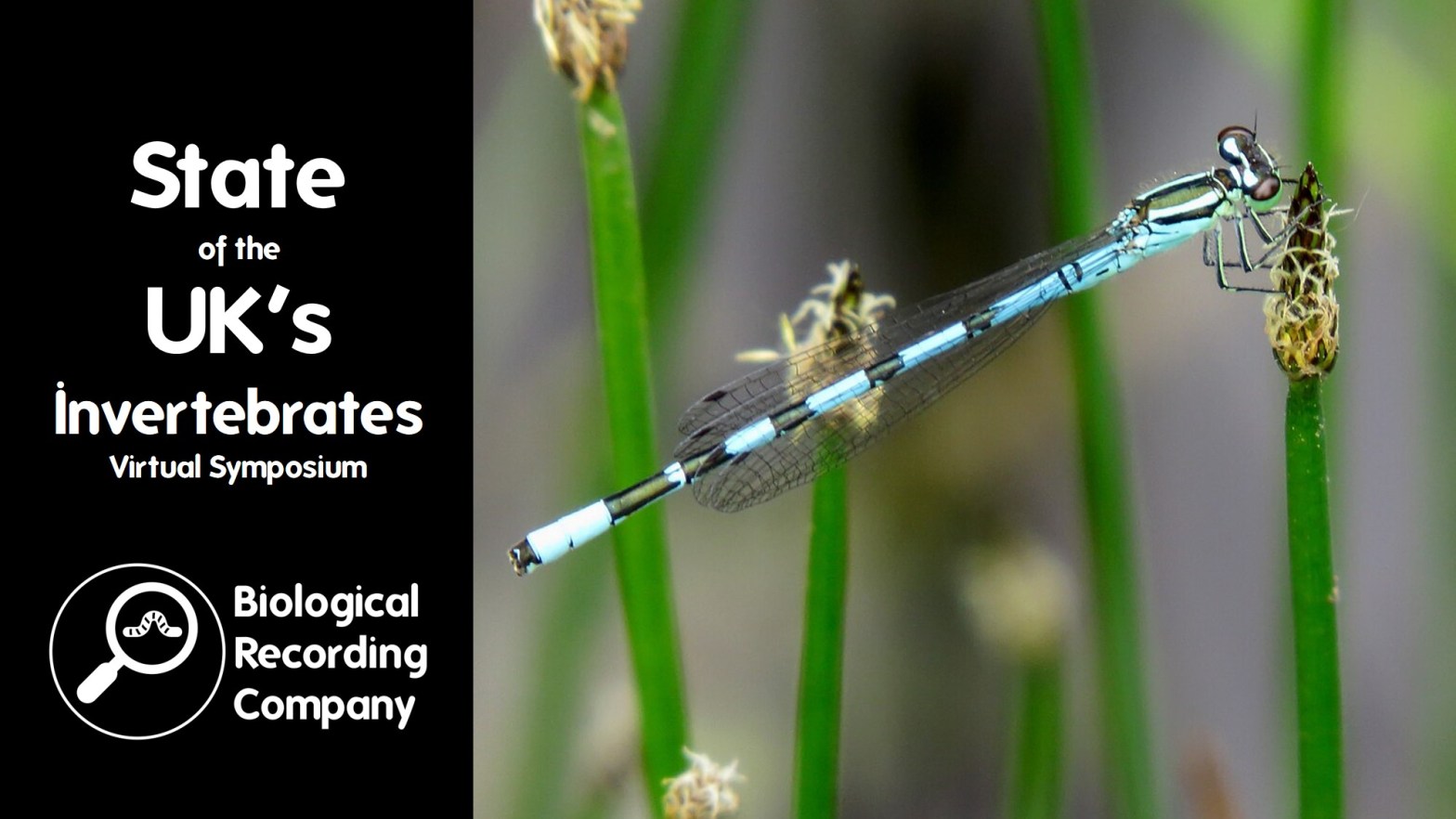
British invertebrates make up the majority of our native fauna and provide a wealth of ecosystem services, yet they often fly under the radar compared to their vertebrate counterparts. Understanding the status of invertebrate populations is vital to evidence-based conservation but with only a fraction of our invertebrates assessed against IUCN Red List criteria, how can we ensure that we are protecting populations that we don’t understand?
The 2023 State of Nature Report unveiled alarming statistics: 476 of our beloved invertebrates are teetering on the brink of extinction, with their species distributions decreasing by an average of 13% since 1970. It’s a wake-up call to action!
The State of the UK’s Invertebrates Virtual Symposium brought together a range of invertebrate specialists to showcase some of the innovative work that is being undertaken. This blog explores what is being done to improve our understanding of British inve
Speaker Programme
This event featured four presentations from invertebrate specialists:
Monitoring, Modelling and Mitigating UK Insect Declines: 20 years of Research at UKCEH with Dr Claire Carvell (UK Centre for Ecology & Hydrology)
Ten Years of Invertebrate Surveying in the Natural England Field Unit with Pete Boardman (Natural England)
Britain’s Endemic Invertebrates with Craig Macadam (Buglife)
Assessing the Status of UK Earthworms with Keiron Derek Brown (Biological Recording Company)
Monitoring, Modelling and Mitigating UK Insect Declines: 20 years of Research at UKCEH
Dr Claire Carvell (UK Centre for Ecology & Hydrology)
Researchers at UKCEH have played a major role in collating and analysing biological records and survey data to track changes in the status of UK insects. This presentation highlights some of the insights gained, focusing on the last 20 years, including the latest updates from the UK Pollinator Monitoring Scheme. It also features parallel research into management interventions on farmland to better understand how we can mitigate against further insect declines and conserve the critical ecosystem services that insects provide.
Ten Years of Invertebrate Surveying in the Natural England Field Unit
Pete Boardman (Natural England)
This second iteration of the Natural England Field Unit (NEFU) will celebrate its tenth year in 2024. NEFU currently has 5 entomologists working on condition assessments for the organisation, as well as contributing to a host of other entomological work, including DNA work, supporting PhDs, training and a range of other work. This presentation introduces a range of this work, showing the valuable entomological work NEFU does.
Britain’s endemic invertebrates are the crown jewels of our biodiversity. There are 22 endemic species ranging from the Turk’s Earth Centipede to the Manx Shearwater Flea. Last year Buglife undertook global IUCN Red List assessments for 20 of these species. This presentation explains the assessment results and introduces these amazing species.
The standard method for determining the conservation status of a species is to assess the species against IUCN Red List criteria and apply an IUCN Red List category. These criteria require species data, and many species can therefore only be classed as ‘data deficient’ based on current record holdings. UK earthworms fall into this category and are rarely considered within site management plans, environmental policy or conservation projects.
The Provisional Earthworm Conservation Status Assessment for the UK aims to apply a provisional version of the IUCN categories for all 31 UK species of earthworm based on the little data that we do have and the opinions of the UK’s leading earthworm specialists. This presentation explores this experimental approach and highlight the benefits and challenges resulting from this project.
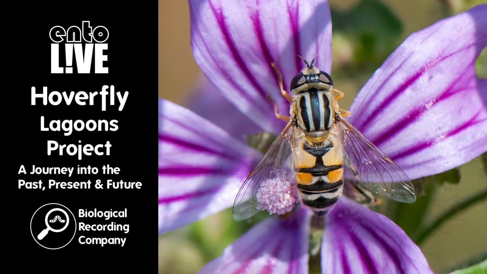
The Hoverfly Lagoons project was invented in 2016 for the University of Sussex’s Buzz Club, a citizen science charity exploring wildlife gardening techniques for insects. The aim was to trial artificial habitats, essentially small water bodies designed for some (magnificent) species of hoverfly which are semi-aquatic. These water bodies may be missing in our urban and rural landscapes due to a lack of natural habitats such as mature trees. The Buzz Club learnt that: Hoverfly Lagoons are very easy to create; size doesn’t matter (much); they’re used by a broad invertebrate community; and they could be a useful tool to investigate biological unknowns and to monitor environmental change. Dr Ellen Rotheray takes us through her lagoons journey – past, present, and plans for the future.
Dr Ellen Rotheray is a senior lecturer in Ecology and Conservation at the University of Sussex, a member of the IUCN Hoverfly Specialist Group, and a member of the Pine Hoverfly Biodiversity Action Plan (BAP) Steering Group. Ellie got her first taste of hoverfly research during her masters degree in 2006, which opened up a new, exciting world of discovery and exploration. What’s more, due to the nature of the project, it was an opportunity to apply scientific findings directly to shape effective conservation management. Inspired by habitat creation efforts trialled during her PhD, Ellie invented the Hoverfly Lagoons project, largely in the hopes that when people caught a glimpse inside this world, it might evoke a desire to protect it.
Q&A with Dr Ellen Rotheray
Are the hoverfly larvae prone to predation in the lagoons and what would dine on them? The Muscid flies that I mentioned in the presentation are the main predator, and are like a fox in a henhouse and will empty a lagoon of hoverfly larvae. Larvae will also be predated by vertebrates such as birds, foxes and frogs – essentially they are a little sac of protein and fat. I expect that dragonfly larvae would eat them in a pond, but it is unlikely that dragonflies will colonise the low-oxygen habitat that you find in hoverfly lagoons. There are also parasitoid wasps that specialise on individual species of hoverflies.
Are all hoverflies able to survive as larvae over winter? It would be cool to study this more. I would imagine that multiple species have developed strategies for surviving in colder areas, such as up in Scotland. We’ve found Pine Hoverflies completely frozen in the ice and within a few seconds of being chipped out of the ice, they would slowly begin to start moving again! I’ve also used temperature-controlled environments to investigate how they behave in colder conditions and I noted that as the water started to freeze, Pine Hoverfly larvae immediately crawled out of the water and sat on the ice! I can’t really comment on other species, but the species that are found in cooler climates seem to have adapted to survive in these conditions.
What other organisms are found in hoverfly lagoons? There is a whole community of organisms found within the hoverfly lagoons. The hoverflies (and Muscid larvae) are probably the biggest and easiest to see, but there will be other species of fly (such as gnats and mosquitoes) and parasitoids that are associated with the insects inhabiting the lagoon.
What can people do in their gardens to help improve their hoverfly diversity? The first thing would be to set up a hoverfly lagoonand report their results. Taking part in this project helps us understand more about hoverfly behaviour and ecology, which we can then use to improve our guidance. It’s particularly useful if people do these for several years running so that we have sites where we can compare the data year-on-year. Aside from hoverfly lagoons, allowing areas to grow and so-called weeds to flower is great for adult hoverflies. Ensure that you have plants flowering all through the year to provide habitat for early and late species. Increasing the diversity of habitats is also going to increase your hoverfly diversity – so think about adding a log pile and pond. Finally, avoid using any chemicals – you shouldn’t need to if you have a healthy ecosystem as some hoverflies (not those that inhabit lagoons) will predate aphids!
entoLIVE webinars feature guest invertebrate researchers delving into their own invertebrate research. All events are free to attend and are suitable for adults of all abilities – a passion for invertebrates is all that’s required!
entoLIVE is delivered by the Biological Recording Company in partnership with the British Entomological & Natural History Society, Royal Entomological Society and Amateur Entomologists’ Society, with support from Buglife.
The entoLIVE programme is delivered by Biological Recording Company and receives sponsorship from the following organisations:
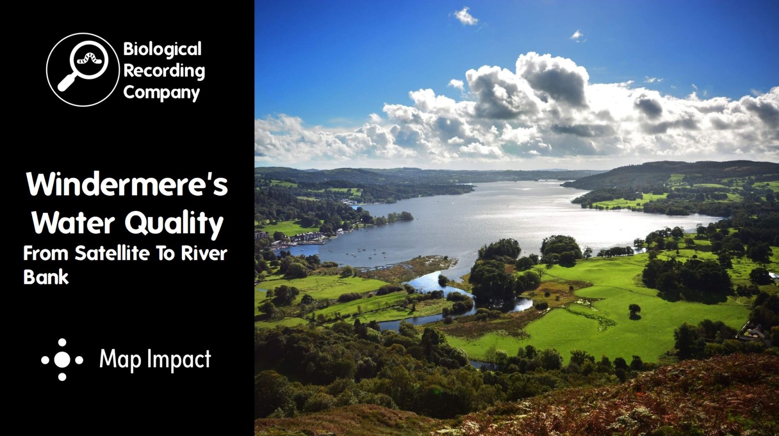
The water quality of our rivers, lakes and seas is a hot topic, with water companies under fire for the amount of raw sewage being discharged into British waters. The impacts of this can be devastating for our wildlife and can impact food supplies, human health and tourism.
Lake Windermere is located in the heart of the Lake District and is also England’s largest lake (by area, length and depth). It supports a diverse range of wildlife and is pivotal for the tourism sector that supports the region economically. It was also central to ‘The Water Pollution Cover-Up’ episode of BBC Panorama due to incidents of high phosphorus levels causing algal blooms that turn the lake green and suffocate the wildlife within its waters.
This blog looks at some of the evidence behind these algal blooms. We’ll explore different sources of data, such as invertebrate monitoring, satellite imagery and human activity data to establish if a common cause can be established. the blog features the following presentations:
Windermere’s Water Quality: Invertebrate Insights with Dr Sam Green (WildFish)
The Health of Windermere: A Satellite Perspective with Richard Flemmings (Map Impact)
Panel discussion facilitated by Matt Staniek (Save Windermere)
Windermere’s Water Quality: Invertebrate Insights
Dr Sam Green (WildFish)
WildFish, in collaboration with Save Windermere, formed a SmartRivers hub in 2023 to begin surveying the freshwater invertebrate populations on the rivers and becks feeding into Lake Windermere. This project aimed to get a clearer picture of the ecological health of the Windermere catchment, and in particular how water company assets could be impacting biodiversity and water quality.
The results from the first year of invertebrate surveys have been published on the WildFish website and monitoring for 2024 is already underway. This presentation provides a greater understanding of the importance of invertebrate monitoring and an overview of our findings so far.
Dr Sam Green is a freshwater ecologist at WildFish primarily supporting the SmartRivers programme. WildFish is the only independent charity in the UK campaigning for wild fish and their habitats. We identify and lobby against the key threats driving the decline in wild fish populations, from various forms of pollution to open-net salmon farming. Ultimately, our goal is for fresh and coastal water habitats that are clean, healthy, biodiverse, and able to support sustainable populations of wild fish.
Q&A with Dr Sam Green
Is Smart Rivers connected with the Riverfly Partnership, to ensure effective collaboration? Yes. SmartRivers is one of the Riverfly Partnership’s Riverfly Plus schemes. The two schemes complement each other in terms of monitoring rivers, but ARMI data and SmartRivers data do different things. The acute issues monthly bankside monitoring sampling is designed to pick up pollution events and uses family-level identification. SmartRivers uses species-level identification with monthly monitoring and twice-annually deep dives into the chronic pressures on rivers.
Do you find a higher abundance of tolerant species in polluted waters or a lack of sensitive species (such as mayflies)? We look for shifts in the entire invertebrate community as often when you lose pollution-sensitive species, more tolerant species can exploit this vacated niche and increase in numbers. Certainly, in our Windermere data we’ve seen examples of higher numbers of pollution-tolerant species at downstream sites like the New Zealand Mud Snail and other pollution-tolerant molluscs and true flies.
Why is data not collected during the summer season? The SmartRivers sampling protocol only involves collecting two seasons of data: spring and autumn. It would be great to have data from year-round sampling but capacity makes that unrealistic, both due to the fact that the sampling is volunteer-led and that WildFish is a relatively small conservation charity.
How are the sediment and phosphorus pressure scores derived? The scores are calculated using methodologies that have been peer-reviewed and use the information on the invertebrate communities recorded, i.e. the presence and absence of specific organisms and the numbers that are recorded within a sample. This is calculated using mixed-level taxonomic data for the sediment pressure score (PSI – the Proportion of Sediment-sensitive Invertebrates index) and family-level data for the phosphorus pressure score (TRPI – Total Reactive Phosphorus Index).
What are the main chemicals impacting the sites? The SPEAR biometric indicates the presence of chemical stress on invertebrates, but unfortunately not what chemicals are impacting the sites. SPEAR values indicating chemical stress can be the first step in longer-term projects aiming to identify the chemicals causing problems in our rivers. For example, teh scores could be used to locate sites for more resource-intensive monitoring methods such as chemcatchers.
Is it possible to have free access to your open-source database? Yes. Email smartrivers@wildfish.org to obtain free access to the dataset.
To bring further understanding to the growing environmental issues at Lake Windermere, Map Impact, in collaboration with various stakeholders, embarked on a project aimed at introducing fresh perspectives and novel data sources to the study of the lake’s ecosystem. This effort received backing from the UK Space Agency under the Climate Services funding initiative. The project, which ran for six months, concentrated on combining satellite technology, human movement data, and climate data to provide further understanding of the influences and factors affecting lake nutrient content.
The results of the project have been openly published within a comprehensive report that includes methods, confidence and limitations. This is being used across the community to support understanding of the key factors affecting water health and inform mitigation activities that counteract pollution.
Attendees will be provided with an understanding of:
The advantages and limitations of satellites as an important information source.
How satellite information has been correlated with various other data sources to show trends and new information about the state of the Lake.
How this data can be applied to support the future protection of the Lake and wider catchment area.
Richard Flemmings has specialised in applying geospatial and satellite earth observation data to environmental challenges throughout his career. He is interested in taking a highly collaborative approach to ensure that these data feeds can benefit as much of society as possible.
Q&A with Richard Flemmings
How could visitor numbers be responsible for algal bloom events? Visitor numbers put a strain on the wastewater infrastructure, potentially leading to increased nutrient input if not treated properly.
What software do you use to interpret the satellite data? We mainly used Google Earth Engine and Python for interpreting satellite data.
How do you exclude other factors such as weather when assessing the correlation between visitor numbers and algal blooms? The approach that we’ve taken is to look for correlations between peaks and troughs in chlorophyll content with peaks and troughs in temperature and other weather events. There are times when we can’t exclude these potential factors because visitor numbers and temperature/weather are often linked. However, through statistical analysis we have shown that there are situations where the weather does not appear to be the influencing factor and human movement is.
Is there scope for improvement of water quality monitoring with the use of real-time monitoring devices and sensors? Absolutely/ We’ve taken landscape and remote perspective using open-source specific-point data to train our model. I think there is huge potential for adding in other aspects, such as in-situ sensors that measure the level of chlorophyll at set points within the lake and feed this data into the model. Combining these technologies opens up huge opportunities.
Matt Staniek grew up in Windermere and studied Zoology at university, before returning home. Matt was appalled when he found out that sewage is being discharged into our lake and at that moment, decided to dedicate his life to solving this issue. Save Windermere has grown into a registered not-for-profit Community Interest Company (CIC), governed by a Board of Directors. We are all based locally in Windermere and care deeply about our wildlife, our community and our lake.
Are there other organisations monitoring the same or other aspects of Windermere and how does their data fit with yours? Richard: One of the things covered in the project technical report is how we compared our data to the Big Windermere Survey data, and how it helped us reach the conclusion that we did. We also used some of the openly available EA data. All of these datasets should be open access so it is easy to use them alongside one another. There are a lot of people and organisations working within this space and this was a relatively short project, which limited how much some stakeholders were able to collaborate.
Are there plans to introduce methodologies to identify and test for the chemicals that are polluting water courseways? Sam: The SmartRivers methodology uses a metric called SPEAR to assess if there is chemical pressure, but it can’t tell you what chemicals are causing issues. However, SmartRivers does help us figure out where on the water course it is best to invest resources in further monitoring, such as the use of passive water quality devices like chemcatchers within the river to determine which chemicals are present and at what concentrations. The issue is that this can be expensive to undertake and as a small conservation charity we would require collaboration with bigger agencies that have the resources and capacity to undertake such monitoring.
What can individuals do on a national scale to improve water quality in our rivers, lakes and seas? Sam: We do need to hold water companies to account, but we are also responsible for own personal behaviour. Everyone can make small changes, such as considering the impact of letting our dogs swim in rivers and lakes when we’ve used spot-on flea treatments that a specifically designed to nuke invertebrates. If people want to go further, getting involved with citizen science projects (such as SmartRivers) is a great way to contribute towards cleaner water. Richard: Personally I am involved with Surfers Against Sewage as a surfer who is regularly in the sea. Even if you are not able to get involved with a campaign group such as Save Windermere or Surfers Against Sewage, take the time to follow what they are reporting on to stay engaged and ensure that awareness of these issues is maintained.
Are there any mitigation actions being taken within this catchment as a result of these results? Richard: By making the results from the satellite project openly available, our aim is to provide objective evidence to justify and support mitigation activities. This includes improving general awareness of algal blooms in the lake and providing the appropriate justification for reducing these over time. We also see a lot of discussion relating to nature based solutions to improve water quality (for example, in support of improving riparian edges) and satellite data has huge potential to support targeted intervention and monitoring to show that changes in water quality are happening. Sam: The data generated from SmartRivers monitoring is only the start of our monitoring programme. We’ve already collected data for Spring 2024 and will continue doing so in the years to come. Once we have a few years of data we can begin to really investigate the trends we are seeing in the catchment and use the data to lobby for change. Our data is open access for anyone to use. We’ve had feedback from United Utilities, some of which helpful and some not (see our blog), and I know Matt is in discussion with the local Environment Agency. So hopefully in the future we will be able to constructively work with them and use the data as we have with the agency in other parts of the country.
Bioacoustics is a cross-disciplinary science that combines biology and acoustics, using the sounds produced by animals to investigate their biology and ecology.
Sound recorders can be positioned within a habitat to record the calls produced by birds and other animals, and these recordings can be analysed to establish their behaviours and which species are present. Artificial intelligence and evolving hardware are helping us to push the boundaries of what we can use this technology for, with the potential to use bioacoustics to establish species abundance and overall ecosystem health on the horizon.
It can be used for short and long-term measurements of biodiversity, including how species richness changes through the seasons and over the years. It also helps understand how birds are using a site, for example using bioacoustics to look at the site preferences of Skylarks.
This blog features two guest presentations:
How Can We Use Sound to Measure Nature? with Geoff Carss (Wilder Sensing)
Using Sound to Understand How Biodiversity is Changing: The Story of Honeygar with Joe Hampson (Somerset Wildlife Trust)
Geoff will introduce how the science of bioacoustics is used to monitor and measure biodiversity, delving into the current limitations and potential applications. We will explore how sound has been used to identify species and recent innovations such as Merlin and BirdNET together with scalable approaches for short and long term monitoring. Featured on Springwatch 2024 episode 11.
How can we ensure we have accurate and robust validation of sounds using AI? The validation is really important. We ran trials for well over a year, with Honeygar being one of them. This has included a lot of work from volunteers undertaking validation, including species-specific validation. Customers have also run their own validation trials. As mentioned in my presentation, there are some species that we know are problematic and more care needs to be taken with interpreting their presence.
How reliable are the confidence scores? For most species, it is pretty high at around 80% or 85%. This will be variable by species, particularly with species that have lower frequency calls.
Is the use of acoustic monitoring in urban and suburban areas more limited due to the impacts of human-generated noise? We have one site in the industrial part of Bristol. When you listen to the recordings you can hear the constant sound of lorries and other traffic. However, despite this, we’re still picking up quite a reasonable species list. This has included species that we knew were present but didn’t expect to be picked up, including things like Sparrowhawk. What’s important is that the results are compared like-for-like to give us a picture of what is happening over time. We understand that some species may be missed due to their low-frequency calls, but they will be missed consistently and we can still use the data to look at changes over time.
Do the filters allow for the possibility of species moving outside of the areas where they may have traditionally been due to climate change? This will depend on the filter that is used. If, for example, we used the British List then this would catch everything but birds that have never been formally recorded in the UK which is unlikely but may happen due to climate change. An option would be to extend the list to include species which may occur.
Can you target surveys at specific species? Absolutely. We’ve had projects looking specifically at Skylark or Curlew. If a project is targeting a species that is less likely to be picked up, we’d need to fine-tune the model for that species to increase the probability of it being detected when present.
Is there a suggested number of recorders per hectare for similar habitat? There is a bioacoustic survey guidelines that were published about a year ago. They should be at least 100m apart if not more – up to 250m. This will depend on what you are aiming to analyse.
How easy is it to deploy this system outside of the UK? It is relatively straightforward. One consideration would need to be which filters you might use. For example, BirdNET would use e-bird so you’d need to check how good the e-bird recording is. You would need to add a local species list as the filter rather than a UK species list. Some regions are going to have less data available, whereas others (such as the Amazon) have relatively good representation.
Are any attempts being made to integrate data on habitat change or weather patterns alongside the species data? We have got some detailed weather data from some sites such as Honeygar and will start to include it in the analytics to better understand causality and the impact of bird assemblages. This could be the subject of a great PhD.
Are there any case studies available where bioacoustic monitoring has been successfully used on conservation projects in the UK? The Somerset Wildlife Trust Honeygar example is a great case study as presented below. There are a number of very different sites around the Uk who have installed a number of recorders – Wendling Beck in Norfolk, Leven Carrs in Yorkshire and North Moor in Somerset (Natural England) – we can provide more examples and put you in touch with appropriate contacts – please let us know.
Using Sound to Understand How Biodiversity is Changing: The Story of Honeygar
Honeygar will be Somerset Wildlife Trust’s first ‘wilded’ site – managed very differently to our nature reserves and a major project for the Trust, which will happen over many years. Over time, we hope it will become a place which inspires those who visit, whether other landowners, local people or visitors from further afield.
Joe will provide a short history of Honeygar and delve into the details of the acoustic project that’s been running there for 18 months and has 1.5 million records uncovering all kinds of insights.
How much work is it to maintain the equipment? We’re very fortunate to have volunteers that manage this. With the older model, we needed to change the batteries each week but the newer models have batteries that last around a month. the bottleneck now is the SD cards as we fill a 128GB SD card in almost exactly two weeks so we’re having to change these fortnightly (with every other SD card changed at the same time as the batteries).
Is the data from your recorders submitted to the Local Environmental Records Centre? All of the data that we get from Honeygar is shared with the Somerset Environmental Records Centre. I think they’ve been scratching their heads a little bit about how much data we are producing on-site, but it’s hopefully helping them to prepare for how this kind of recording may generate large volumes of data in the future. We’re also analysing the data and we hope to publish research based on the data that we’ve generated, to help disseminate the findings beyond the biological recording sector.
Do you aggregate a day’s worth of calls for a single species as one record? Each call is separate, so it is important that we don’t draw conclusions about the number of individuals based on the number of calls. In the pie chart that I showed, you may have noticed we had lots of Wren calls – this is because they are such noisy birds. We’re not saying we have 500 individual Chiffchaffs because we’ve had 500 Chiffchaff calls. As time goes on and more data is gathered for the site, changes in levels of noise will be useful for commenting on bird activity levels and help us to understand changes on the site. As this technology develops, triangulation of calls may enable us to look at species abundance.
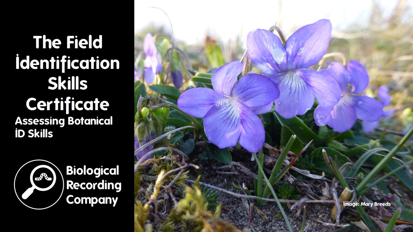
The Field Identification Skills Certificate (FISC) is a test that assesses your botanical proficiency on a scale from 1 (beginner) to 5 (professional), with a level 6 awarded in exceptional cases. Originally developed by Sarah Whild and Sue Dancey, the BSBI’s FISC Development Working Group (including a number of experienced FISC Assessors) now supports and oversees the running of FISCs.
The FISC assesses your real-life botanical skills and is gaining popularity and becoming an industry standard, with some consultancies sending their staff annually to encourage skill development. This talk will discuss how the assessments are improving the quality of professional botanical skills, especially in light of recent changes to legislation and the introduction of BNG, as well as their impact on the “amateur” botanical community.
Dr Chantal Helm is the BSBI’s training coordinator responsible for FISC and Identiplant. She is also a terrestrial ecologist with field experience in South Africa and the UK, with a broad interest in natural history. After a decade in academia, Chantal now focuses on delivering local voluntary conservation projects, encouraging local biological recording, undertaking freelance bat surveys and supporting students as a visiting lecturer, alongside her part-time BSBI role.
Q&A with Dr Chantal Helm
How much does it cost to undertake a FISC assessment? It is up to the individual provider what they charge. It is also up to the provider what they pay their FISC Assessors. The only fixed cost is a set fee that is payable to BSBI for the quality assurance, coordination and development of the FISC. Each candidate will have this set cost incorporated in the fee that they pay the provider. BSBI doesn’t run any FISC assessments in-house and FISC assessments are all delivered through partners. Prices are very variable and range from £125 (for students with one provider) to around £260 (for professional consultants).
How many people can have on a single FISC assessment day? Again, this depends on the provider. We recommend a maximum of 25 people, because of the amount of space that you need for specimens in the labs and for monitoring the participants in the field to ensure that they are following the rules.
Why have FISC assessments not been rolled out in Scotland? We’ve been trying to encourage experts at the appropriate level to come forward and become FISC Assessors in Scotland. Taking on the assessor role is a fair bit of work so a number of expert botanists are reluctant to take it on. We are having conversations with the Royal Botanic Garden Edinburgh regarding the possibility of some of their staff running FISC assessment days from next year. We’re keen to expand into Scotland, as well as Wales, Northern Ireland and Ireland.
Why do BSBI recommend that FISC assessment days are not included at the end of training courses? It’s all about ensuring that there are no biases. Firstly, we wouldn’t want the assessor to be in any way linked to the students in teaching. We also wouldn’t want students to have training on the same sites that are being used for the assessment. The outcome of FISC assessments could also be biased if the students have knowledge of the specimens being used or have been trained on the local flora to the assessment site. Ideally, if a course was being provided that included a FISC assessment day, the students would be shipped off to another region and an independent FISC assessor would lead the day.
What FISC level would an Identiplant graduate expect to achieve upon completion of the course? We suggest that someone who has completed Identiplant to a satisfactory level and who then engages the following year with their local botany group and/or gets out recording plants to practice their botanical field skills may be able to achieve a FISC level 3 the following year. Obviously, it is going to vary by person and it is really important that field botany is practiced regularly in order to cement those skills.
This presentation will explore how image recognition and artificial intelligence (AI) can revolutionize the identification of insect species. By leveraging advanced machine learning algorithms and high-resolution imaging technology, UK CEH aims to enhance the accuracy and efficiency of monitoring insect populations. Alba will discuss the development and application of the Automated Moth Identification (AMI) system, which exemplifies these technologies in action. Additionally, she will highlight the role of citizen science in this initiative, enabling broader participation and data collection. This approach not only provides critical data for addressing the biodiversity crisis but also bridges the gap between technological innovation and ecological research.
Alba Gomez Segura is a Research Software Engineer at the UK Centre for Ecology and Hydrology, where she develops and applies new technologies to monitor biodiversity. With a background in Environmental Science and Bioinformatics, she now focuses primarily on electronics and coding. Her interests include hardware (e.g., cameras and Raspberry Pi) and software (machine learning) to enhance insect monitoring in the field, aiming to provide more and better data to tackle the biodiversity crisis. She is passionate about bridging the gap between technology and biological research, driven by a deep passion for understanding the natural world.
Q&A with Alba Gomez Segura
Where were the training images for the moth image recognition algorithm sourced from? Our main source of images was the Global Biodiversity Information Facility (GBIF). As the model progressed, we were able to tweak the model using images gathered through the AMI, as GBIF images are often good quality and it is useful to add in images that are more representative of what the AMI will capture. With two seasons of AMI data from some sites, we now have lots of images that can be used for training. However, there are some limitations with this data such as the fact that some species may not come to the AMI very often or event at all. Therefore, we will continue to use both GBIF and AMI images for training the model.
Do you stop training the AI once you have reached the point where the accuracy is no longer improving? We have a maximum number of images to help us focus our efforts on species that we have fewer images for. However, we can use more than 200 images if needs be and this may be particularly useful for species that are more difficult to identify. The number at which the accuracy starts to plateau is variable by species. We tend to tell people that at least 100 images are needed to start with, but it can be less for particularly distinctive species and more for species that are more difficult to distinguish from other species.
Are the images that you are gathering available through an open-source platform? The idea is that these images will be stored on an open-source platform. The images that we have taken from GBIF are not owned by UK CEH and are already open source. For the UK CEH-generated images, these are currently stored on our in-house data centre. As our projects are taking place around the world, it is likely that our data will feed into national data centres once we have this all setup.
Does the image recognition only work with the setup you have described or could this be used on a range of light traps? The model should be general enough to work across different setups. For example, in the Netherlands it has been used successfully with a different set-up that includes a yellow sheet.
Does the model only consider the image or can other factors (such as temperature, location etc.) be used to reach a species determination? Currently, the only other factor considered by the model is location, so we have different models for different regions (for example, we have separate models for the UK, Costa Rica and northern USA/southern Canada). We are looking into other factors and did a test last year that investigated if moth activity and temperature correlated with each other. At the moment we will probably use things like phenology to check that the model matches what we already know. We already have a lot of abiotic data for the images gathered, such as date, vegetation around the AMI and sunset/sunrise times so there is potential to look at these factors in more detail in the future.
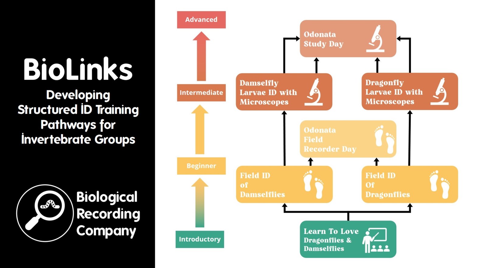
The FSC BioLinks project aimed to address the shortage of biological recorders for under-recorded and difficult-to-identify invertebrate groups through a substantial training programme based on structured ID training pathways for each focus species group. This presentation will focus on the classroom, field and lab-based training courses delivered through BioLinks, and discuss the challenges and successes demonstrated by BioLinks in relation to developing species ID skills in the biological recording community.
Keiron Derek Brown has been running the National Earthworm Recording Scheme since its launch in 2014. He has been working as a biological recording professional since 2017 when he joined the Field Studies Council where he developed and then delivered the FSC BioLinks invertebrate recording project. Following the completion of this project, Keiron set up the Biological Recording Company to support the environmental sector through training and consultancy.
Q&A with Keiron Derek Brown
Did learner inexperience in using microscopes decrease bookings for microscope-based courses? Not at all. The microscope courses were the most popular of all the 1-day courses. Some learners were already experienced, but we checked this with the participants at the beginning of each course and the project staff member would support the specialist tutor by providing inexperienced learners with an introduction to setting up and using the microscope. We also run 1-day courses that were designed specifically to give confidence in the use of microscopes and identification keys for identifying invertebrates. The Identifying Terrestrial Invertebrates course is a course that I can provide through the Biological Recording Company if organisations or projects are looking to include it within their training programmes.
What are the pros and cons of delivering in-person versus online courses? I think that both are really important as they both have advantages and limitations. Online courses are great for delivering courses at relatively low cost and for reaching much larger audiences. They enable you to reach a much larger geographic area and access people who wouldn’t be able to attend in-person courses (for example if they have limited mobility, insufficient financial capacity to afford the travel or work/family commitments that prevent them from taking the day out to attend). In-person courses are fantastic for building relationships between the tutor and students, as well as between students. There is also no substitute for the tutor support that takes place on in-person ID courses, and the equipment (such as microscopes and ID guides) can be made available to students. It can be very difficult (possibly impossible) for tutors to give specimen-specific feedback to online students that they can give on in-person courses.
Did your courses allow for different learning styles and account for neurodivergent people? Many natural history tutors are not professional educators, so not all were aware of learning styles and adapting their teaching methods to these. The project team provided feedback and guidance to the specialist tutors as much as possible and I co-designed theTeaching Natural Historycourse with Charlie Bell to address this issue. It teaches the tutors that different people learn in different ways and advises tutors to introduce a range of different teaching styles to account for this. I can provide it through the Biological Recording Company if organisations or projects are looking to include it within their training programmes. Regarding neurodiversity, this was something that we also tried to address by contracting the National Autistic Society to review one of our online courses, provide the FSC with guidance for improving teaching materials for individuals with autism and to deliver a webinar about autism to FSC staff and associate tutors. You can read more about this in the FSC BioLinks Audiences Engagement Report.
Were your students subsidised or self-funded? Students were responsible for covering any travel expenses, but the spaces were highly subsidised. One-day courses were £5 initially and £10 towards the end, and the 3-day residentials were £50 (including food and accommodation). We learned pretty early on that we needed to charge something as we initially had a lot of no-shows. There is an argument that if you offer things for free people don’t value them, and I think that you still get this with subsidising to the extent that we did. When natural history courses are full price, many people complain that they are too expensive – but we need to be honest and clear that natural history courses should be valued at the same comparable courses from other sectors.
Did you find that your learners were mainly professionals or non-professionals? We had a real mix. We were careful not to target professionals as the target audience was potential and existing biological recorders. Professionals should really be paying full price for the training, rather than getting it through a funded project and we didn’t want to undermine existing training provision for professionals (delivered by the FSC or externally). However, we did not police who attended and we people with all sorts of motivations: professionals, early career ecologists, students, amateur naturalists, existing biological recorders and conservation volunteers. Likewise, the skill level was often variable even within a course. We did make it clear in course descriptions where existing skills and experience were necessary (for intermediate and advanced courses) and every course was clearly labelled with the level from the BioLinks Learning Pathway. Check out the FSC BioLinks Development Plan for Training Provision for more info about the levels.
Did you look at the diversity of attendees? All project participants were asked to complete an anonymous demographics survey that enabled us to gather information on age, gender and ethnicity. BioLinks specifically aimed to ensure that women were not underrepresented (which they were not – they were actually overrepresented) and that young adults were targeted (which we did through various initiatives), there’s much more info on this work and what the results were in the FSC BioLinks Audiences Engagement Report.
Is there a possibility of developing a postgraduate or higher level course incorporating all this specialist training? The training programme was designed as single units within taxonomic frameworks, so the courses could be combined and incorporated into either (or both) postgraduate training or a higher-level course. I’d love to see this! The obvious candidate would be the PgC/PgD/MSc Biological Recording and Analysis that is delivered by Harper Adams University and the Field Studies Council. However, there is absolutely no reason why this type of training couldn’t be incorporated into more higher education courses.
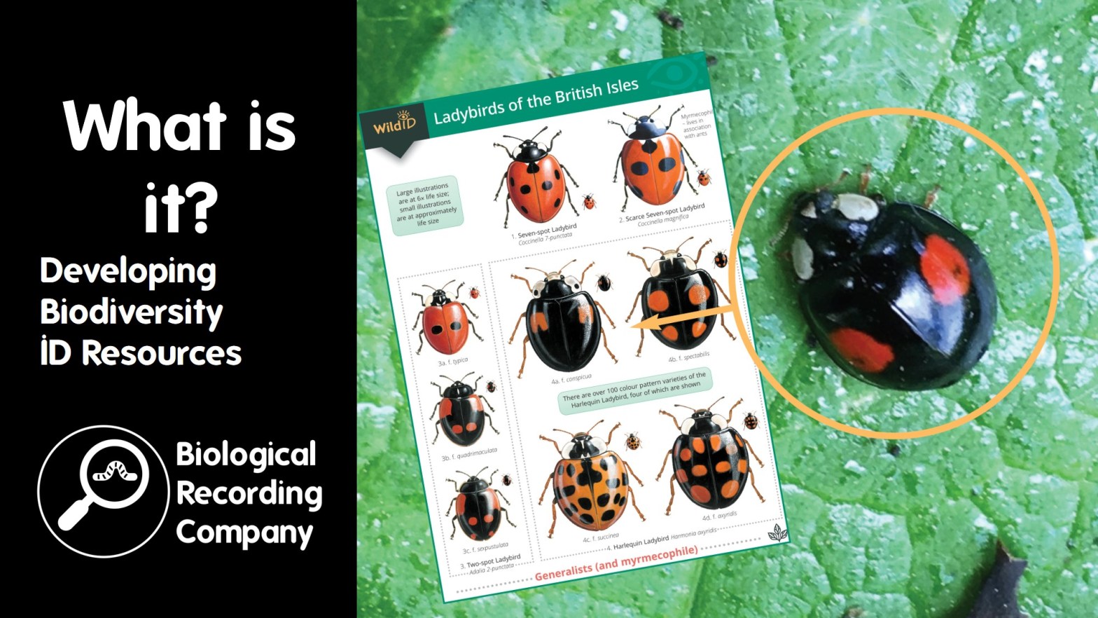
A lack of suitable resources hampers identification. A good guide needs to be suitable for the user’s level of experience as well as accurate and easy to use. Over 40 years ago the AIDGAP (Aids to Difficult Groups of Animals and Plants) project started to develop ‘user tested’ keys, this since has grown into a range of over 175 identification resources.
Dr Rebecca Farley-Brown is Head of Publications for the Field Studies Council, where a key part of her role is the development of identification guides that are both accurate and accessible. Over the last 25 years Bek has helped produce over 200 identification resources, including guides for beginners and citizen science projects, WildID fold-out guides, AIDGAP books and specialist keys (with the Freshwater Biological Association, UK Centre for Ecology & Hydrology, Royal Entomological Society and Linnean Society of London).
Q&A with Dr Rebecca Farley-Brown
Have you had much kickback regarding concerns that beginner’s ID guides are ‘dumbed down’? We had a lot of kickback initially as people were concerned that we were dumbing down and making things too simple, with the opinion that species ID was a job for the experts. The perception of this has changed hugely over the years, with a better understanding that there is a need for a range of guides at different levels. It is important to make it clear what level an ID guide is aimed at and be clear about any limitations.
How are these guides funded? Originally the project was grant-funded, with money from the Natural Environment Research Council and the Linnean Society of London. Most publications are now self-funded, with the sales of the guides feeding back into the development and production of guides. Some guides, such as the slug and freshwater snails guides, were produced as part of projects where the author had included the production of a guide as part of the project plan.
What are the pros and cons of testing workshops versus mailing out test guides to testers? Workshops enable you to watch people and see how they are working through the guide. You can also check to see if their identification is correct. However, if an expert is on hand in these workshops (which they usually are) it can lead to the expert coaching the workshop attendee to the correct answer, which is not something that would usually be available to a user of the guide. If you are sending things out blind, you need to be aware that your testers are likely to be of varying ability and some may not be the true target audience of the guide. You need to ensure that you really sort through the comments and figure out which comments are valid, looking for patterns or consensus regarding issues. It’s a balancing act, but there is a role for both! If anyone is interested in trialling future AIDGAP guides, they can get in touch via aidgap.pu@field-studies-council.org.
What are the pros and cons of scientific illustrations versus photographs in ID guides? Stripped-down black and white line drawings are great pinpointing features important for ID, but it can also be difficult to match what you are seeing on a specimen as it may look less obvious than the line drawing suggests. Colour photographs give a much more representative image of what the reader would expect to see. Personally, I prefer it when guides use both side-by-side. Colour photography has come a long way as most people now have access to relatively decent cameras on their s smartphones and the cost of producing colour guides has come down considerably.
Hopkins & Freckleton (2006) Declines in the numbers of amateur and professional taxonomists: implications for conservation: https://doi.org/10.1017/S1367943002002299
Löbl et al (2023) The Silent Extinction of Species and Taxonomists—An Appeal to Science Policymakers and Legislators: https://doi.org/10.3390/d15101053


