
Achieving Biodiversity Net Gain with all developments will be legislated in November this year in England. Understanding the presence and health of ecosystems on both proposed development sites and sites being used for biodiversity offsets is a pivotal component of this for ecologists to produce habitat condition assessments.
This blog discusses the potential role of satellite imagery in the use of habitat condition assessment and monitoring, and if there is a role for it alongside traditional on-the-ground surveys. A live virtual symposium was held on 15 November 2023, with presentations from Dr Dan Carpenter (an ecologist) and Richard Flemmings (a data scientist), followed by a transcript of a panel discussion that was hosted by Sally Hayns (CEO of the Chartered Institute for Ecology & Environmental Management).
The Role of Satellite Data in Biodiversity Net Gain
Dr Dan Carpenter (Digital Ecology)
With an increasing range of sensors, ever-improving resolution, and frequent data updates, satellite represents an enormous resource for observing planet earth. Myriad environmental applications have already been found for satellite data, but where might it be useful in biodiversity net gain? In this talk, Dan Carpenter will share his thoughts on the potential applications, as well as the limitations, of satellite data for BNG.
Dr Dan Carpenter is a Digital Ecologist working at the interface of ecology and digital technology. He is interested in how digital tech can be harnessed to help deliver better biodiversity outcomes.
- Walrus from space: https://www.wwf.org.uk/learn/walrus-from-space
Elephants from space: https://www.bath.ac.uk/announcements/counting-elephants-from-space/ - Rainforest deforestation tracking: https://earthobservatory.nasa.gov/images/145988/tracking-amazon-deforestation-from-above
- Wildfire monitoring: https://earthobservatory.nasa.gov/images/151407/raging-fires-in-nova-scotia
- Digital Ecology website: https://digital-ecology.co.uk/
- Follow Digital Ecology on LinkedIn: https://www.linkedin.com/company/digital-ecology/
Satellites for Environmental Monitoring – Advantages and Limitations
Richard Flemmings (Map Impact)
Satellite data has long been used to measure environmental variables. The view from above has the advantage of covering large areas of the landscape, whilst collecting consistent and repeatable data that is objective. Combined with novel data analytics approaches, satellites can provide indicators of vegetation quality, vigour and biodiversity at scale. However, there are many things that a satellite cannot achieve. This candid presentation will draw on case study examples to demonstrate what satellites can and can’t achieve.
Richard Flemmings has specialised in applying geospatial and satellite earth observation data to environmental challenges throughout his career. He is interested in taking a highly collaborative approach to ensure that these data feeds can benefit as much of society as possible.
- More info on the BiodiversityView tool: https://www.mapimpact.io/product/biodiversityview/
- Check out the MapImpact website: https://www.mapimpact.io/
- Get in touch with Map Impact to discuss their products and services: info@mapimpact.io
- Follow Map Impact on LinkedIn: https://www.linkedin.com/company/map-impact/
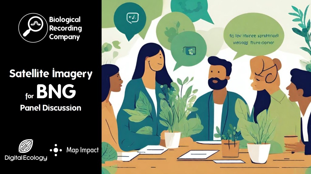
Satellite Imagery for BNG Panel Discussion
Hosted by Sally Hayns (Chartered Institute of Ecology and Environmental Management)
- What’s a ‘spatial framework’?
Dan. A spatial framework is where there is an agreed set of boundaries for representing data. For example, OS MasterMap, where OS have mapped all of the polygons on the ground that we can then apply information to it, such as noting the habitat of a polygon.
Richard: UKHab is trying to bring together a framework for habitats that is the defacto framework that everyone uses. Map Impact uses a hexagon framework that works not just for the UK, but globally.
- How is woodland condition assessed?
Dan: Woodland condition is assessed on the ground using the condition assessment provided alongside the metric provided by Defra. This uses a set of criteria, including structural diversity, deadwood etc. These data are shared with Map Impact, who then look at if they can detect the same woodland condition based on satellite imagery.
Richard: With the satellite data, we take each piece of woodland and look at the satellite spectral signatures to understand how it is performing. This is compared with all of the surrounding woodlands within a 10 km radius. This tells us where it sits in terms of performance.
- Does Map Impact use its own dedicated land classification system to contribute to its map or is it solely based on a collation of other open-source land cover maps and parameters?
Richard: Currently this is solely based on a collation of other open-source information.
- What are the sources of open data already available for habitat mapping?Dan: Natural England Living England data – this is good for habitat data currently on version 4 and is constantly being updated. There is also the CORINE Land Cover, Open Street Map Land Cover data and the CEH Land Cover Maps.
Richard: The open data that we are using includes all of the data mentioned by Dan, but also incorporates part of the open Ordnance Survey datasets and several other habitat layers published by Defra and Natural England (such as their priority habitats data). We’ve initially focused on England while building this dataset, but we’re also in the process of expanding this to cover Northern Ireland, Scotland and Wales and hope to have these UK-wide datasets ready by early 2024.
- Is there any provision for mapping smaller habitat segments that might be part of corridors or stepping stones?
Richard: There is some really interesting work going on around habitat mapping. That’s not something that Map Impact are currently directly addressing – we are using open-source habitat data to feed our tool. There is potential for small habitat segments to be mapped down to a high level of detail. However, there is a trade-off as it can be quite costly to obtain imagery at this fine level of detail. It may be more cost-effective to actually send out a surveyor, so it is important to consider financial viability.
Dan: There are a number of other methods for gathering these data that may be much more cost-effective, such as ground surveys, LiDAR and UAV. The power comes from combining these sources of data and picking the right tool for the right job.
- What size of land holding can your tool provide a screening assessment and habitat quality overview for?
Richard: The minimum area size that we are currently providing is 10HA within the BiodiversityCheck report. - Is there a repository for this UK Hab / condition assessment data to improve accuracy in these models going forward?
Sally: Many ecologists are carrying out UK Hab condition assessments on a daily basis and it would be great to have these collated in local repositories, possibly hosted by Local Environmental Record Centres.
Richard: This doesn’t yet exist, however, as Sally said, it would be great to have ecology surveys and condition assessments collated in local repositories, possibly hosted by Local Environmental Record Centres.
- Have you explored higher-resolution RGB imagery?
Richard: We are using Sentinel-2 data. We have looked at higher-resolution data but the coverage and cost are not suitable to provide a country-wide and consistent dataset. The model uses existing open source datasets to identify the habitat type, and depending on the habitat type, a number of satellite-derived indices are applied to observe the condition using a range of scores that then align with a “Good, Moderate, Poor” condition for that habitat. These are assigned a confidence score based upon comparisons between the satellite observations for the habitat, compared with ecologist observations on the ground using the Defra Biodiversity Metric Calculator.
- How much ground truthing of these outputs has been undertaken and what level of confidence do you have by habitat type?
Richard: The approach that we’ve taken assigns a confidence score for each report, with a banded level of confidence ranging from high to low. This is calculated based on comparisons between the satellite data and on-the-ground surveys by ecologists to understand how accurate the satellite data is. We’ve collected hundreds of points this year, but we are aware that this isn’t enough and we’ll continue to keep adding ground-truthed data as time goes by. The more we add, the more the confidence levels will improve. There are limitations to when we can do the ground-truthing For example, we need to assess grasslands in summer (and ensure we are comparing these to satellite imagery taken during summer).
Dan: The ground-truthing is essential to give users the confidence that the numbers coming from the satellite data reflect reality. I’ve been working with Map Impact to go out and do various habitat condition assessments across England. We’ve also worked with others who can provide data that has been collected in the same way. We have a programme for next year to gather more data and try to capture some of the subtleties, such as capturing the different types of grasslands and sub-habitats. - Is this screening assessment a valid BNG baseline survey using metric 4.0 and could replace the need for an ecologist’s survey on the ground?
Richard: The satellite approach does not replace the need for an ecologist to provide an in-situ ground survey that is compliant with the requirements of the Defra Metric Calculator.
- Do you think we will be using satellites for monitoring offsetting sites into the future over the next 30 years, to ensure they are being appropriately managed?
Richard: Satellites are a very useful tool to consistently and repeatably observe sites over long periods of time to ensure appropriate management. However, it is important to use a consistent data source and a consistent approach in terms of level of detail and output. This will ensure that sites are monitored in a consistent way and that comparisons can be drawn over a long period of time. Sometimes, improving the level of detail will make this a difficult task to achieve.
Dan: I think satellite data will be part of the tool kit of monitoring, but really we need to be thinking about more integrated approaches to monitoring, that make the best use of data, technology and surveys to really determine the success or otherwise of BNG. - Corporate reporting frameworks like TNFD recommend using the Biodiversity Intactness Index and the Ecosystem Integrity Index, do you think there is scope to use these to track and monitor sites under BNG or other compliance schemes?
Richard: Yes, there is scope to align monitoring requirements to potentially fulfil the needs of both BNG and TNFD. Whilst different frameworks are being developed that align with different reporting requirements, it’s important that they remain flexible enough to allow cross-compatibility. Satellites are a potential common data source that offers the wide area coverage and objectivity needed to link these frameworks together.
Dan: The Biodiversity Intactness Index is a species-based index, so satellite data are not appropriate here. However, they may be used in part to help with determining the Ecosystem Integrity Index which looks at measures of structure, function and composition. - What role do you think AI could play in this technology?
Richard: There is huge potential for AI considering the amount of data that is being captured. The number of satellites gathering data is constantly increasing, resulting in an enormous amount of data. There are limits to how much data humans can reasonably trawl through so AI provides great potential to extract the information that is useful from these huge data sources.
Dan: It’s important to remember that the term AI is applied to a range of things, not all of which will be applicable to analysing satellite data. As Richard has explained, machine learning and deep learning (i.e. using computers to look at patterns) are where I see the real value of AI in complementing the skills of data scientists and ecologists to analyse the data.
Event Partners
This webinar will be delivered by the Biological Recording Company in partnership with Map Impact and Digital Ecology.
More for environmental professionals

4 thoughts on “Can Satellite Imagery Data Be Used For Biodiversity Net Gain?”