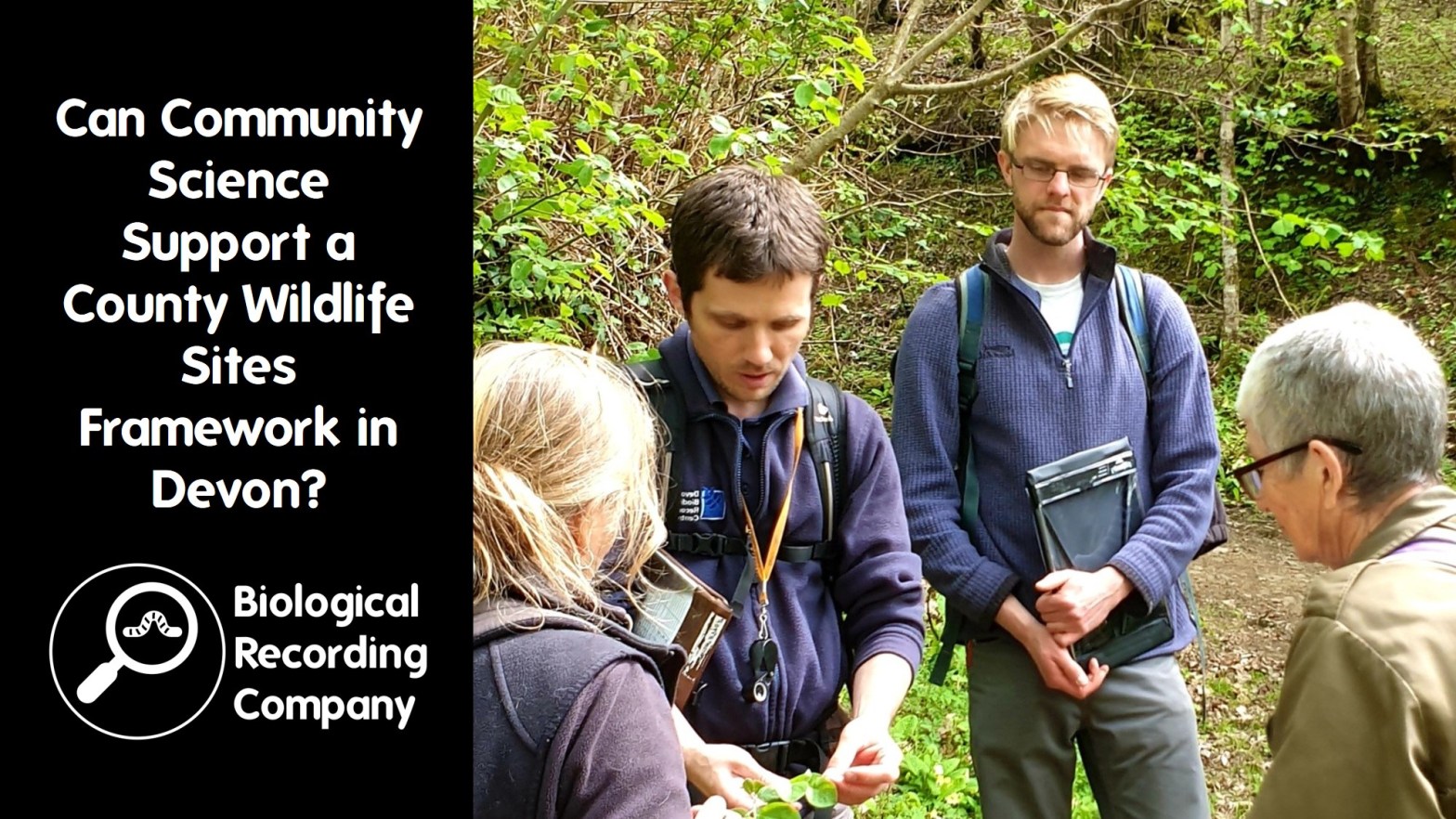
Devon Biodiversity Record Centre (DBRC) undertake the monitoring of County Wildlife Sites in Devon. As well as traditional professional surveys, DBRC have been trialling a new approach to monitoring, involving local community groups. Jess discusses their experiences, including the benefits and challenges of taking this approach.
Jess Smallcombe is Devon Biodiversity Record Centre’s Community Ecologist. DBRC has been working with local communities on a variety of projects to record wildlife, upskill surveyors and take a novel approach to monitoring.
Q&A with Jess Smallcombe
- How often do you get to individual sites on average?
Larger sites that are known to have particular significance for Devon may get revisited more often, but I’d estimate that it could easily be over a decade between site visits – some haven’t been revisited since they were designated in the 90s. That wait between visits is likely to get longer as more sites are designated. We would love to visit sites more regularly so that we have a better idea of site condition at any one time, but with a survey time of about 2.5 people, we would need more funding to do this. - Do you have some sites you always survey each year to get a baseline for comparisons?
With my scientific head on, that would be a fantastic thing to do. The issue is capacity as we can only visit about 70 sites per year. – we have our existing 2,000 sites to return to and 4,000 sites that we’ve yet to assess. Therefore, repeating the surveys at some sites every year would mean returning to existing sites less often and assessing fewer of the sites that have yet to be visited. - How do you identify the landowners?
It’s a bit of a mixture. We do use the land registry, which can at least give an address of the associated property. But it is very time-consuming. We look for local knowledge too, especially in the parishes and districts we have connections with. - What is the general reaction of private landowners to your requests to survey their land?
The majority is positive, but of course, there is a diverse range of responses! To contact landowners, we send them a letter that includes a map, and information about what we do in the survey. We ask them to sign for permission for us to survey, so most of the people that take the time to respond are positive. Some people do say no and give no reason. Others may not want their site designated, for example, because they have plans to sell or develop it at a future date and are worried about how a site designation may impact planning permission. We also have some that are really proud of their sites, but may not be managing it in quite the right way and are really appreciative of our advice. - Do you need to seek permission from landowners before designating sites?
In the past this was an issue as situations have occurred where we’ve had permission to survey and when the landowner was asked permission to designate the site, they’ve said no. As a result, we now ask for permission to survey and designate in that initial correspondence with a single tick box. This helps us prioritise sites that we can designate if they meet the criteria. We have a backlog of sites to visit and surveying sites that we can’t designate has a lower conservation impact. Obviously, if we had unlimited resources and capacity we would survey every site! - Where you have landowners decline permission for survey do you keep the site on record?
We do, but we put it at the bottom of the metaphorical pile. We may ask again after a few years. There might be a change in ownership or attitudes. It will still be on our system as a certain type of habitat, as part of a different data layer, which contributes to the overall picture of the county. - Do you only designate based on vascular plants?
The surveys that I’ve talked about today are habitat assessments and therefore based on the vascular plant communities that are present on site. These sites will be designated for specific habitats. We do also have sites that are designated for species, for example, we have sites designated for Cirl Bunting (Emberiza cirlus) because they are key sites for this species which has seen a massive drop and is now going through a fantastic recovery. - What level of botany do you require of volunteers?
Our survey team are trained botanists and have the botanical skills required to undertake habitat classification competently. Within the volunteers, there is a wide range of botany skill levels. We have some really good botanists helping out with the project and we have some that are just starting to build their skills. We provide training on how to do the surveys and we try to pair up novices with experienced botanists so that we know the surveys will be accurate and to help novice botanists develop their skills and knowledge. - Are you just trialling using volunteers for surveying unconfirmed sites or are they also monitoring existing sites?
After discussion with the groups, it was decided that it was simpler to ask them to look at unsurveyed wildlife sites. Monitoring County Wildlife Sites requires extra skills in also looking at management and assessing whether the site is improving or declining in quality. Also offering advice to landowners on management if needed. Our initial discussions decided that assessing a site to set criteria alone, rather than to set criteria and previous surveys was the way to go. - Have you considered using satellite images to undertake surveys remotely?
Although we could get a general understanding of the habitat type, the satellite data is not going to be detailed enough to identify individual plant species, particularly rare ones, which might make the difference in designating a County Wildlife Site, as well as being important records in themselves. We have yet to find a process that can match “boots on the ground”. We have used aerial images to identify potential sites, but they still need surveying before designation. Our trial of doing rapid survey assessments had this issue. - Can data gathered on iNaturalist and sites like restor.org be integrated into your data?
Date from iNaturalist and iRecord does filter through to us, but it does take time for it to get to us. Biological recording is really important and all data is useful and helps us with the range of services that we provide as a Local Environmental Record Centre. When submitting data through online recording platforms, please ensure that your records don’t have a non-commercial licence applied – as we can’t use these records for record centre business. It’s also worth checking your geographic resolution settings to ensure that we’re getting a record to at least the nearest 100 m and including the name of the site helps too. If you are recording on a site in Devon that you think should be designated as a Local Wildlife Site because of the habitat or species that you are seeing – get in touch with us and let us know!
Further info and links
- Devon Biodiversity Record Centre: https://www.dbrc.org.uk/
- CWS criteria and info on DBRC website https://www.dbrc.org.uk/information/sites-and-habitats/
- Upcoming free entoLIVE webinars: https://www.eventbrite.co.uk/cc/entolive-webinars-74679
- Full list of courses and events from the Biological Recording Company: https://www.eventbrite.co.uk/o/the-biological-recording-company-35982868173
Learn more about British wildlife

2 thoughts on “Can Community Science Support a County Wildlife Sites Framework in Devon?”